

-15%
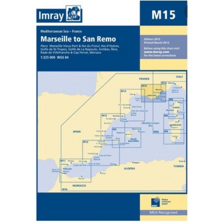
Imray chart m15: marseille to san remo
 100% secure payments


Large coverage of the coasts.
Folding letters, printed on waterproof Pretex paper. Sheet size 640 x 900mm.
All Imray cartography is based on the WGS84 geodetic projection system and all indications are metric.
They are supplied in transparent PVC covers.
Plans included:
Marseille Vieux-Port & Îles du Frioul (1:35 000)
Îles dHyères (1:135 000)
Golfe de St-Tropez (1:70 000)
Golfe de La Napoule (1:60 000)
Antibes (1:15 000)
Nice, Rade de Villefranche & Cap Ferrat (1:30 000)
Monaco (1:20 000)